By: Rachael Tan
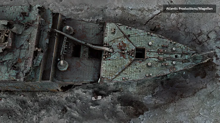
Deep-sea researchers have completed the first full-size digital scan of the Titanic, showing the entire wreck in unparalleled detail and precision.
The Titanic was on its voyage from Southampton, England, to New York City when it hit an iceberg off Newfoundland in the North Atlantic on April 15, 1912. The luxury ocean liner sank within hours, killing about 1,500 people.
Over a hundred years later, the Titanic remains the ultimate memorial in honor of those lives that were lost in its sinking. And the wreck teaches us that looking back and pondering over the wrongs cannot change what has already happened.
A team of Magellan Scientists spent six weeks capturing scans of the Titanic, using technology that had been developed over the course of five years.
The scan had been created using deep-sea mapping. It provides a unique 3D view of the entire ship as if the water has been drained away.
Using remote-controlled submersibles, the company Magellan Ltd spent about 200 hours taking more than 700,000 images of the famous wreck from every angle.
They were then able to stitch each photo together to create the 3D image of the Titanic.
Anthony Geffen, head of documentary maker Atlantic Productions says that previous images of the Titanic were often limited by low light levels, and only allowed viewers to see one area of the wreck at a time. In contrast, he says, the new realistic 3D model captures both the bow and stern section, which had separated while sinking, in clear detail. Even including the serial number on the propeller.
Titanic analyst Parks Stephenson says that not much is known about the actual collision with the iceberg. Speaking with the BBC, he said: “We don’t even know if she hit it along the starboard side, as is shown in all the movies – she might have grounded on the iceberg.”
“There is still much to learn from the wreck,” he added, “She has stories to tell.”


